By BRUCE TOMASO - The Dallas Morning News - Sunday, October 21, 2007Designers of the Trinity River project have an ambitious vision.
They say they want to see the river transformed "from the city's back alley to its front yard."
The central element of that vision, for many people, is the proposed downtown Trinity River park. With its lakes, river meanders, hiking trails, canoeing course, greenbelts and promenades, the downtown park, at roughly 100 acres, is often extolled as having the potential to become Dallas' Central Park, or Dallas' River Walk, or Dallas' Town Lake – an urban oasis that will draw visitors from near and far.
Also Online
Interactive map: Trinity toll road issues
Map:
Trinity toll road issues (.pdf)
Archive:
Learn more about the Trinity toll road fight But there's at least one big obstacle to that vision – or two, actually – having nothing to do with the Nov. 6 referendum on whether to build a toll road in the park.
Unlike Central Park, or the San Antonio River Walk, or Austin's Town Lake, the Trinity is cut off from the rest of the city by its levees – "two 30-foot mounds of dirt separated by a half-mile of weeds," in the memorable phrase of Paul Lehner, director of planning and development for the city's Trinity River Corridor Project office.
"We can't do exactly what they've done in San Antonio," said Mr. Lehner. "We won't have people who can just step out their doors and be right at the water, because of the levees. For that reason, providing connectivity to the park through a number of points has been very high on our list."
The levees, built in the 1920s and '30s to protect downtown against flooding, aren't going anywhere. In fact, the U.S. Army Corps of Engineers plans to raise the levees by about two feet over the next few years.
The corps has said emphatically that whatever else is done to the river corridor – park, lakes, toll road, no toll road – flood protection remains its primary function.
So to get to the park, folks would have to find ways over those "mounds of dirt."
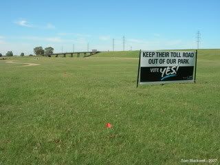
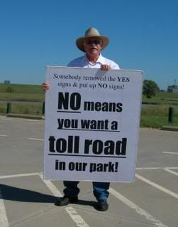
Dallas being Dallas, many of them would drive. Their access to the park depends very much on what happens Nov. 6, when voters will weigh in on Proposition 1, a ballot measure to scrap the high-speed toll road now planned inside the levees.
Whether that toll road is built – and, if it isn't, what gets built instead – will affect many aspects of the Trinity project, from its funding sources to its build-out schedule to the aesthetics of the park to transportation through and to the central city. One of few things that both sides agree on in the toll road debate is that a lot of uncertainty looms – and a lot of recalibration will have to take place – if Proposition 1 passes and the toll road is scrapped.
In ways big or small, the vote could alter almost everything and anything about the park. So all of what follows is open to change. There are lots of things we simply don't know about how the Trinity project might look.
But for now, let us forget about toll roads, figuratively park our cars, lace up our walking shoes and take a stroll through some of the plans for ways that Dallas residents would be able to get to, and enjoy, their park on foot.
Reunion Overlook This would be one of the prime entry points to the downtown park – and, Mr. Lehner hopes, a gathering point in and of itself.
Reunion Boulevard is the short roadway off Houston Street that now passes the Hyatt Regency Dallas, Reunion Tower and Reunion Arena before dead-ending at Industrial Boulevard.
Under its plans, the city would extend the boulevard another few hundred feet to the west, to the river levee. There, a building of some sort could be built – there is no final design now – at the level of the levee top. The building could house an information center, perhaps a history museum of the Trinity River, perhaps concession stands. From it, there would be "vertical access" via elevators or stairways, down into the river bottoms. At that point, visitors would be in the park, at the promenade along the water.
Mr. Lehner told a City Council committee last week that the Reunion Overlook could evolve into the main "linkage between downtown and the Trinity Corridor."
The trails The park is to include a network of trails – some near the water and some, perhaps, along the tops of the levees.
Near Sylvan Avenue, these trails would connect with the Trinity Strand Trail, a new trail network being built just outside the levees, behind the Stemmons Freeway along the original, meandering channel of the Trinity River.
The Trinity Strand Trail, in turn, would eventually hook up with the Katy Trail at a point just north of American Airlines Center.
That means hikers, joggers, bicyclists and roller-skaters could come down the Katy Trail from as far away as Southern Methodist University – and eventually farther, as the Katy Trail expands – and get into the Trinity park.
And from the Knox-Henderson neighborhood south, those visitors would never have to cross a vehicular road, said Mike Kutner, chairman of Friends of the Trinity Strand Trail, a group raising private money to complete the trail.
He also noted that there are 13 hotels, including the huge Hilton Anatole, along Stemmons Freeway within a short walk of the Trinity Strand.
"For visitors to our city to be able to walk out of their hotel and get on these trails and enter the park – that would be fantastic," he said.
DART The Dallas Area Rapid Transit station at Eighth and Corinth streets in Oak Cliff is the southernmost station that jointly serves DART's red and blue rail lines.
The station is close to the Trinity, near where the downtown levees stop.
It's also adjacent to an abandoned railroad trestle. That old railroad bridge, city officials said, could be converted to a pedestrian bridge. Visitors from as far away as Garland or Plano could ride DART to Eighth and Corinth and use the pedestrian bridge as a way into the river bottoms.
At that point, they'd be near the northern boundary of the Great Trinity Forest, an unspoiled hardwood stand covering several thousand acres that the city is assembling. A canoe launch into the river channel is also planned at Moore Gateway Park, near the trestle.
Continental Avenue Work has just begun on the Margaret Hunt Hill Bridge, a soaring structure by Spanish architect Santiago Calatrava that will extend the Woodall Rodgers Freeway west over the Trinity to Singleton Boulevard.
It's the first of three Calatrava "signature" bridges over the Trinity that planners hope to see completed someday. The others are at Interstate 30 and Interstate 35E.
The Margaret Hunt Hill Bridge will cost an estimated $115 million, according to the city. It's being built with $28 million in city bond proceeds, some funds from state and federal agencies, and a lot of private donations, notably from the family of Ms. Hill, the oil heiress and Dallas philanthropist who died this summer.
When the bridge is completed, the plan is to close the adjacent Continental Avenue viaduct to cars, allowing only pedestrians and bicyclists to use it.
From the east (downtown) side, the Continental bridge would provide a ready way into the park from the West End, Victory and Uptown.
On the West Dallas side, the city would build a "gateway park" that would afford spectacular park views, framed by the downtown skyline in the distance and the Calatrava bridge in the foreground.
"That becomes the Dallas postcard," Mr. Lehner said.
People walking or biking over the bridge would be directly above one of the man-made lakes that are planned as key features of the park.
"The experience," Mr. Lehner said, "will be unlike anything that you can see now in the city."
Oak Cliff The West Dallas gateway park is one of several spots on that side from which people could enter the park. Another is a planned observation deck that would be built in North Oak Cliff, near Beckley Avenue and Commerce Street, so people could come and watch the progress as the park is built.
"It's the proverbial hole in the construction fence," Mr. Lehner said.
But really, said Bob Stimson, a former City Council member who heads the Oak Cliff Chamber of Commerce, almost anyplace along the levee on the Oak Cliff side would provide ready entry.
"When it comes to accessing the park, Oak Cliff is in a perfect position," he said. "At any number of spots, you'll be able to just walk up over the levees and enjoy this park."
He said that unfettered access is one reason the chamber supports the current Trinity River project plan, which puts all of the highway lanes on the downtown side of the river.
Mr. Stimson said he hoped that Oak Cliff's open access to the Trinity park would "give us a tremendous advantage in the eyes of developers. They'll be salivating at the chance to build over here."
TRACKING THE TRINITY TOLLWAY VOTE What am I voting on? Passage of Proposition 1 would create a Dallas ordinance prohibiting the construction of a high-speed toll road within the Trinity River Corridor's earthen levees. If the proposition passes, any road built within the corridor would be limited to four total lanes with a 35 mph speed limit.
When to vote: Early voting on Proposition 1 begins Monday and runs through Nov. 2. Regular voting for the referendum is Nov. 6. Only registered Dallas voters may participate.
A "FOR" vote means: You want to prohibit the high-speed toll road's construction within the Trinity River's levees.
An "AGAINST" vote means: You want to preserve the current Trinity River Corridor plan, which calls for construction of the high-speed toll road within the levees. What supporters of Proposition 1 say: A high-speed toll road would irreparably harm an adjacent urban park also planned as part of the city's broader Trinity River Corridor project. The road could be built outside the levees, along Industrial Boulevard, or elsewhere.
Supporters of the proposition say that since Dallas is endowed with a massive, empty greenspace in its city center, it should use its prime opportunity to develop it to create an urban oasis, unadulterated by a loud, unsightly highway carrying tens of thousands of vehicles each day.
They also say the toll road may be prone to flooding and would lead to more air pollution in downtown Dallas.
What opponents of Proposition 1 say: Removing the toll road from the larger Trinity project is akin to yanking on threads from a suit: It'll soon unravel.
Private funding for the park element, as well as county, state and federal funding for transportation components both related and unrelated, are contingent on the toll road being built as planned. Passage of Proposition 1 could also delay the project, which was originally passed in 1998, for years.
Opponents of the proposition say that building the road elsewhere could cost hundreds of millions of dollars more, and not building it at all would lead to unacceptable traffic congestion in downtown Dallas.
Voter turnout? Both sides expect it to be low, meaning individual votes carry more strength than in a well-attended election.

